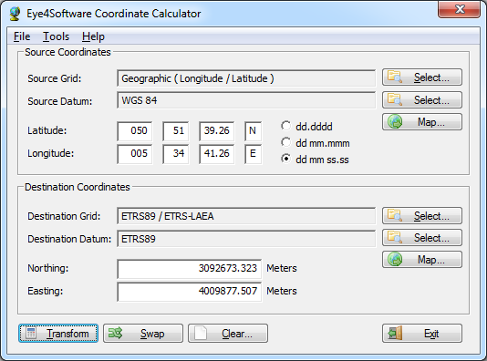
The Eye4Software Coordinate Calculator is an easy to use (freeware) desktop software tool, to convert coordinates from one coordinate system to another. It can also be used to convert coordinates between different horizontal map datums. The software can be used to convert a single coordinate, or to convert a batch of, for example, gps coordinates read from a comma separated file.
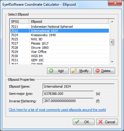
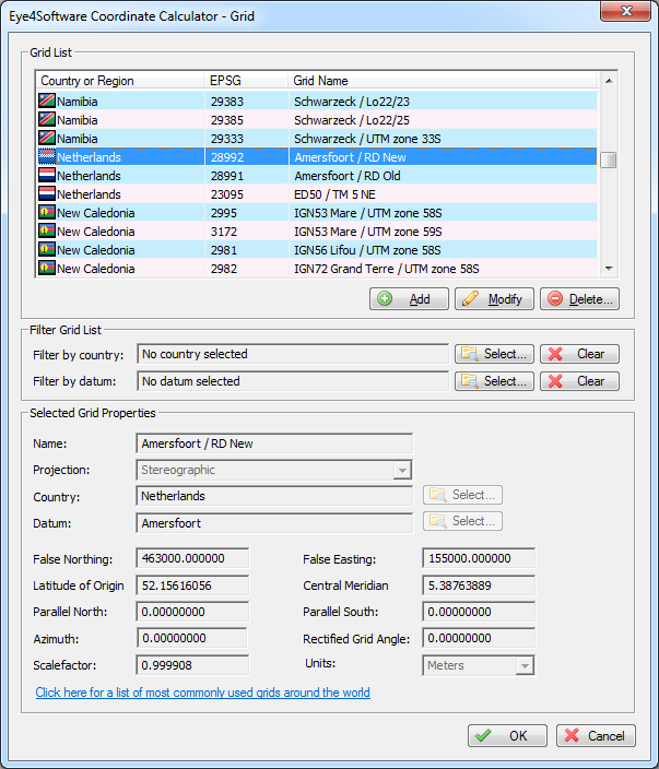
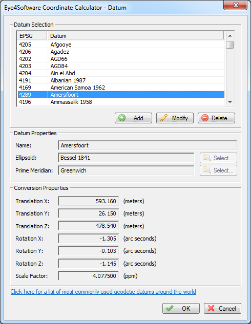
The software is shipped with a SQLite database containing almost any reference ellipsoid, map datum and coordinate system around. It is possible to modify the coordinate systems, reference ellipsoids and geodetic datum definitions stored in the database. You can also create user defined coordinate systems, reference ellipsoids and map datum definitions, so you can always extend the database.
The Eye4Software Coordinate Calculator can convert coordinates from one coordinate system to another using the following map projections:
The following conversions are supported:
To perform map datum conversion between NAD27 and NAD83, as well as between NAD83 and NAD83 HARN, it is possible to use a NADCON correction grid file. NADCON files, as well as HPGN / HARN files are shipped with the product, and the datum definitions to use NADCON are allready built-in.
The coordinate calculator supports datum conversions by using NTv2 (National Transformation version 2) grid files. Using these files, very accurate datum conversions can be performed. Because of the size, NTv2 grid files are not shipped with the product. For further reading, or to download grid files, please have a look at the NTv2 information page. NTv2 grids are mainly used in Canada, Australia, Great Britain (OSTN02), Germany (Beta2007), France and New-Zealand.
Using an easy-to-use wizard, you can translate data files from one coordinate system to another. The data formats supported include: ASCII text files, comma, space or tab separated files ( CSV or Excel ) and databases like MS Access files or ODBC data sources. All you have to do is to select source and destination coordinate system, select the fields and the software will perform the conversion.
Using the batch conversions wizard, it is also possible to convert an ESRI ShapeFile from one coordinate system to another. This may come in handy when you want, for instance, display 2 shape files at the same time, while one file has a different coordinate system. The function can also be used to convert files from WGS84 to a local map grid.
| Some ellipsoids shipped with the product include: Bessel, Hayford, Clarke 1880, WGS84... | Show full list... | |
| Some map datums shipped with the product include: NAD27, NAD83, ED50, WGS84, GRS80... | Show full list... | |
| Some coordinate systems shipped with the product include: UTM, British National Grid, SPCS27, SPCS83... | Show full list... |
The software will run on any desktop or laptop computer, running Windows 2000, Windows XP, Windows 2003 Server, Windows Vista, Windows Seven or Windows 2008 Server Operating System.
The software can be downloaded from the links below or our download page. The software is freeware, which means you can use the full functionality without having to pay anything !. We offer both 32bit and 64bit versions of the software.