Eye4Software Hydromagic is a professional hydrographic survey package, which can be used to map depth areas using an echo sounder and GNSS receiver.
The software is very affordable and the learning curve is very short. You can start creating your first sounding within a single day. Our website contains a lot of free training material so you will be able to learn the software without expensive courses.
A free demo version package, is available for free on the download page.
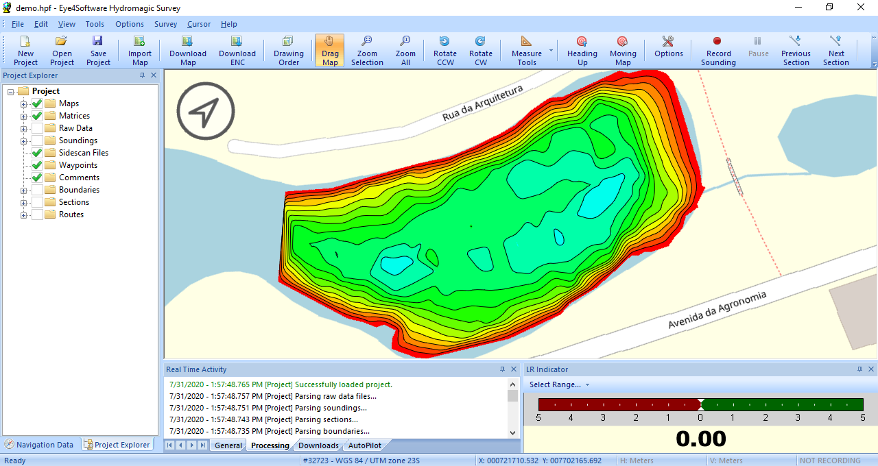 Generate a matrix and depth contours from your corrected soundings. |
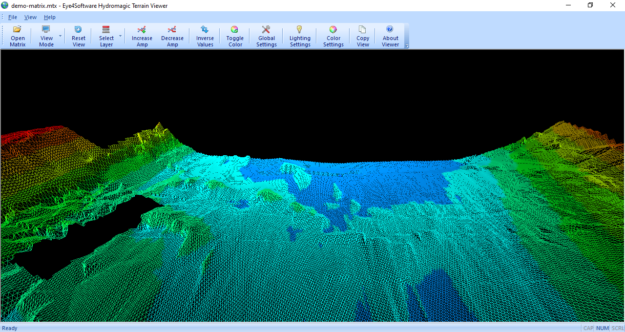 Use the "Terrain Viewer" to get a detailed 3D image of the bottom. |
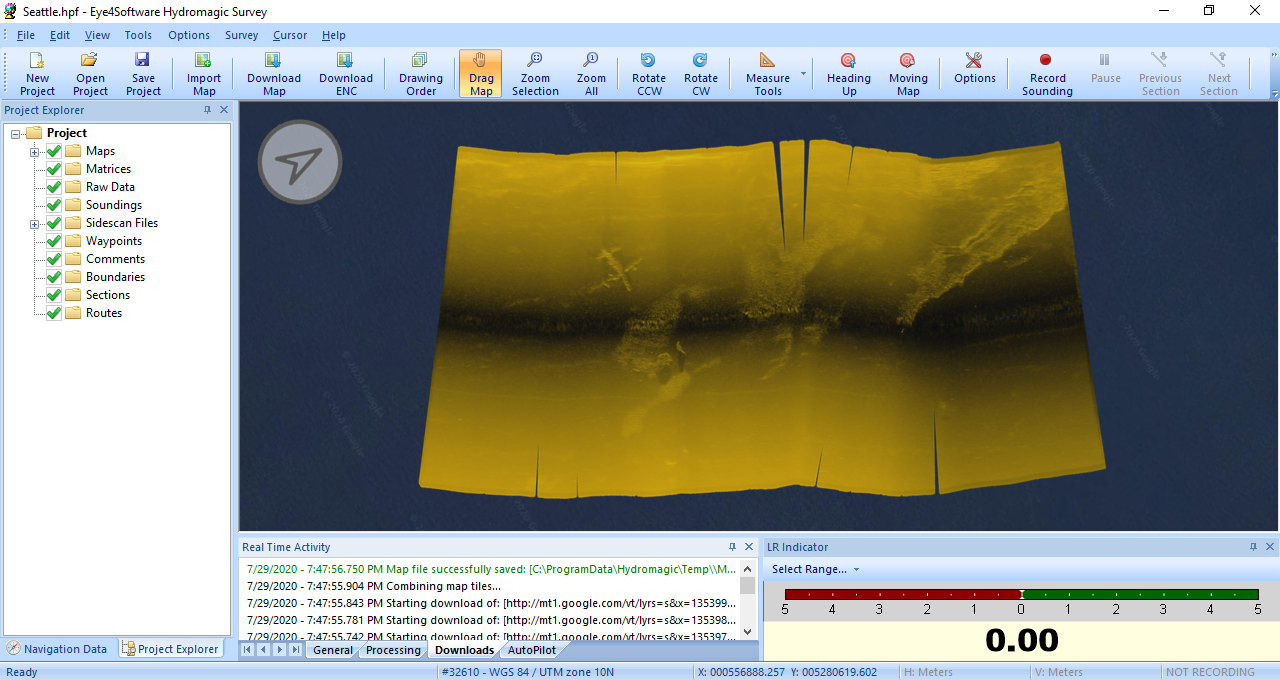 Import side scan sonar data as map overlay in Hydromagic Survey. |
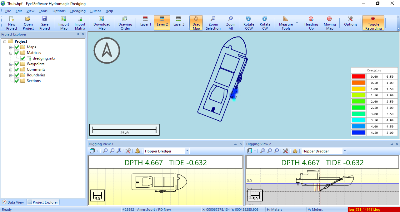 Monitor dredging depth of your cutter, suction or backhoe dredger. |
 Support for GNSS (RTK) receivers
The software can communicate with almost any (NMEA0183 compatible) GPS or RTK receiver to retrieve your current position and height, and show it on one of the support raster or vector maps. In addition, with a RTK receiver, you can calculate tide levels in real-time.
 Support for echo sounders
Hydromagic offers support for a wide range of professional single and dual frequency hydrographic echo sounders from popular brands like CEE HydroSystems, Odom, STN Atlas, SyQwest and more.
 Support for other sensors
Besides GNSS and echo sounder, also other hardware, such as a tide receiver, magnetometer, motion or tilt sensor, heading sensor (compass) or an AIS receiver can be connected. for a full list of supported echosounders and other hardware click here.
 Geodesy
To display a part of the globe on a display, a map projection is needed to prevent distortion of the map data. The software is shipped with a database containing over 5000 predefined local and global map datums and grids.