
Austria
|
These Inland ENC charts offered here contain data from the Federal Office of Metrology and Surveying (Bundesamt f?r Eich- und Vermessungswesen). |
Belgium

|
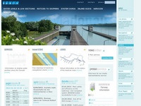
This portal gives access to the various RIS services that are currently available in Flanders. River Information Services (RIS) are modern traffic management systems enhancing a swift electronic data transfer between water and shore through in-advance and real-time exchange of information. An EU framework directive provides minimum requirements to enable crossborder compatibility of national systems. You can also find general information about RIS, the political and regulatory framework, and the technical specifications. |
Bulgaria
|
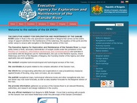
The Whole Bulgarian-Romanian sector of Danube river (km375-km845). |
Croatia

|
CRUP Ltd. is one of the leading European company in the field of development and integration of River information services (RIS) in compliance with the European directives and standards. We are proud of our own RIS management software development and system implementation in Croatia, Slovakia, Serbia and AIS network implementation as a RIS backbone in France on the rivers Seine and Rhone. |
Czech Republic
|
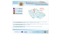
Navigation sheets in Inland ECDIS format can be downloaded in the form of .zip packages. The packages are divided into sections for the Vltava, Elbe and Elbe - a common border section, which contains a separate sheet produced in cooperation with the Federal Administration of Navigation and Waterways of Germany. |
Germany
|
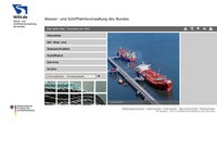
On this website, you can find the free IENC files provided by the Water and Shipping Authority of Germany (Wasser- und Schifffahrtsverwaltung). These are available as ZIP archives sorted by waterway. |
Hungary
|
These electronic navigations charts (ENC) contain data of the Danube stretch rkm 1811 - 1433, on the basis of the surveys made between 2005 and 2007, and have been edited by ?VITUKI? Environmental Protection and Water Management Research Institute Non-profit Ltd (Budapest). |
Netherlands
|
This website gives you up-to-date information about the availability of waterways. This includes information about changes to the operating times of bridges and locks, obstructions and work in progress. You can also find static information, such as regular operating times of bridges and locks and ENCs (Electronic Navigational Charts). In addition, the site provides information about water levels, floating ice and swimming water. |
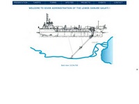
Poland
|
|
Published Inland Electronic Navigational Charts for the Lower Oder area with implemented the RIS system were prepared in an official file format, designed for being used by inland systems of imaging electronic maps and navigational information from Inland ECDIS (Inland Electronic Chart Display & Information System). |
Romania
|
Romanian inland ECDIS files in S57 format. |
Serbia
|
Serbian inland ECDIS files in S57 format. |
Slovakia
|
Slovakian inland ECDIS files in S57 format. |
Swiss

|
Hochrhein inland ECDIS files in S57 format. |
United States
|
NOAA Electronic Navigational Charts (NOAA ENC?) are vector data sets that represent NOAA's newest and most powerful electronic charting product. NOAA ENCs conform with the International Hydrographic Office (IHO) S-57 international exchange format, comply with the IHO ENC Product Specification, and are provided with incremental updates that supply Notice to Mariners corrections and other critical changes. NOAA ENCs and updates are available for free download. NOAA ENC data may be used to fuel Electronic Chart and Display Information Systems (ECDIS). |

|
Today, the Corps of Engineers has initiated a national Inland Electronic Navigational Chart Program to support efficient and safer navigation in the Inland waterways. We are utilizing modern software, mapping, Geographic Information System (GIS), and Global Positioning System (GPS) technologies to transform our traditional paper river charting data into new digital charting products called Inland Electronic Navigational Charts (IENCs). |