
Units
In the 'Units' tab in the Preferences window, you can select the desired units for speed, sound velocity, area, and volumes. You can also select in which format geographic coordinates are represented throughout the software. This tab is pretty self-explanatory, but we will discuss the possible settings below. The unit settings are not configured on a per-project basis (except for horizontal and vertical units) but are part of the software configuration.
Modifying unit settings
To access the unit settings tab, first select the 'Preferences...' item from the 'Options' menu to open the Preferences dialog. In the preferences dialog, click the "Units" tab:
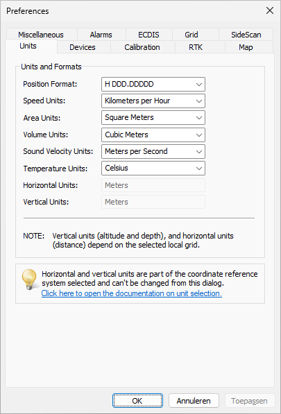
Click the "Units" tab in the preferences dialog.
Geographic position format
The position format defines how geographic (latitude and longitude) coordinates will be displayed throughout the software. These settings will be applied to the data window, cursor position in the status bar, and all dialogs that display WGS84 coordinates (comments, waypoints, sections, etc.).
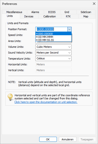
Selecting the geographic coordinate format
Speed units
Speed is displayed in the data window, but is also used in some other dialogs where speed is a factor, like the dynamic draft profile and speed alarm dialog. You can switch between Miles per Hour, Kilometers per Hour, Knots, and Meters per Second using this setting:
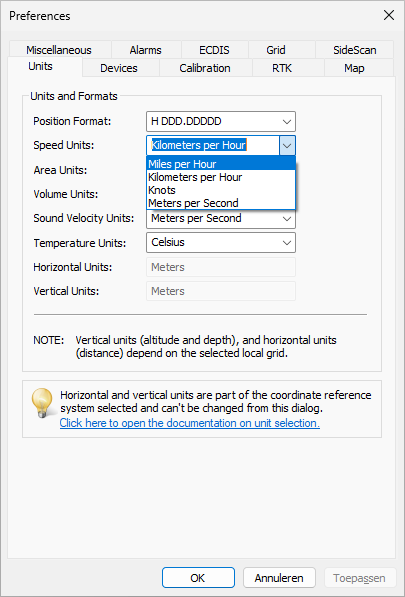
Selecting the speed units
Area units
Areas are used, for instance, in the area calculation tool, but also in generated volume reports and volume calculation tools (matrix comparison, cross-section analytics, and staging volumes). You can switch between Square Meters, Square Feet, Square Kilometers, Square Yards, and Acres using this setting:
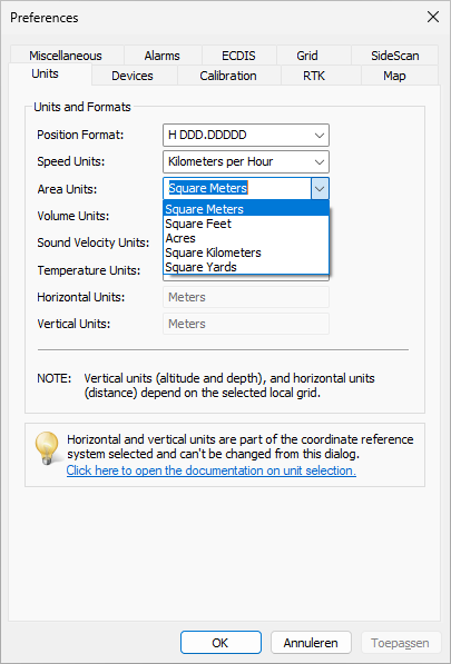
Selecting the area units
Volume units
Volumes are mainly used in generated volume reports and volume calculation tools (matrix comparison, cross-section analytics, and staging volumes). You can switch between Barrels, Gallons, Cubic Meters, Cubic Inches, Cubic Yards, and Cubic Feet using this setting:
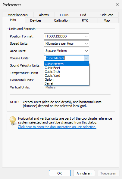
Selecting the volume units
Sound velocity units
Sound velocity units are used in the software to display the speed of sound through the water, as used by your echo sounder. Speed of sound values are used in the data view, sounding wizard and the sound velocity profile editor. You can switch between meters per second and feet per second using this setting:
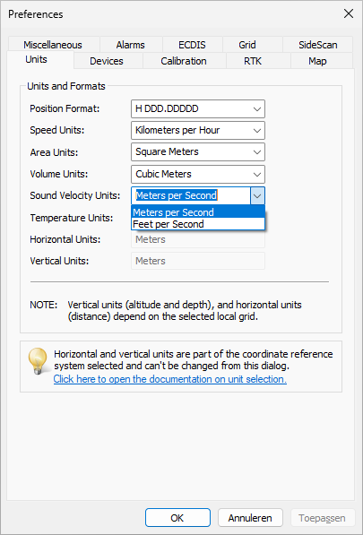
Selecting the sound velocity units
Temperature units
Since Hydromagic version 10.2, it is possible to measure temperatures, like water temperature, air temperature, or system temperature. You can use this setting to switch between degrees Celsius, Fahrenheit, Kelvin, or Rankine.
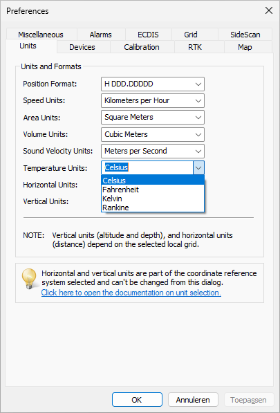
Selecting the temperature units
Horizontal units
Horizontal units are used to display Easting and Northing positions and will be used in distance calculations as well. Horizontal units are part of the geodesy settings and need to be set before creating a new project. They cannot be modified here.
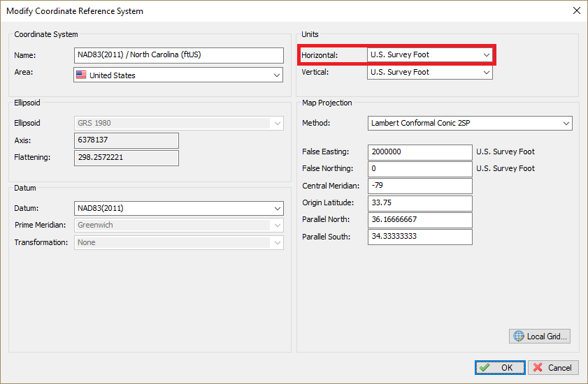
Horizontal units can only be changed in the coordinate reference system definition.
Vertical units
Vertical units are used for altitude, depth, tides, and elevations. Vertical units are part of the geodesy settings and need to be set before creating a new project. They cannot be modified here.
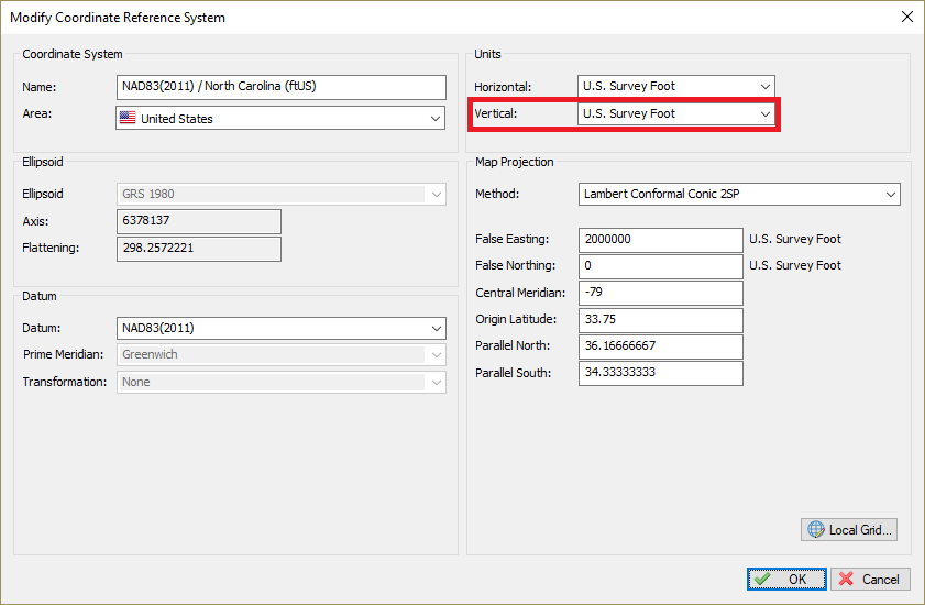
Vertical units can only be changed in the coordinate reference system definition.