
Downloading Electronic Navigational Charts (S-57)
Since version 9.0 of Hydromagic, a built-in map downloader has been added, enabling you to download Electronic Navigational Charts (ENCs) in S-57 format directly from the Internet. Make sure you download this at the office since an Internet connection is required. When downloading in the field using a cellular connection, data charges may apply.
At the moment only maps for the United States are available. Other countries will be added in the future. All NOAA coastal (ENC) and USACE inland charts (IENC) can be downloaded using this feature.
If no Electronic Navigational Charts are available for your location, you can use the regular map downloading tool to download street or topographic maps or satellite imagery for your survey or dredging project.
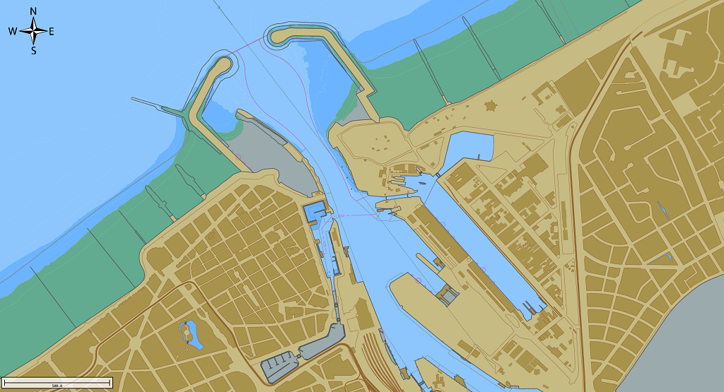
Example of an Electronic Navigational Chart loaded in Hydromagic Survey.
Download ENC tool
To start the map downloading tool, right-click the 'Maps' folder in the 'Project Explorer' and select the 'Download ENC...' option from the pop-up menu, as shown in the image below.
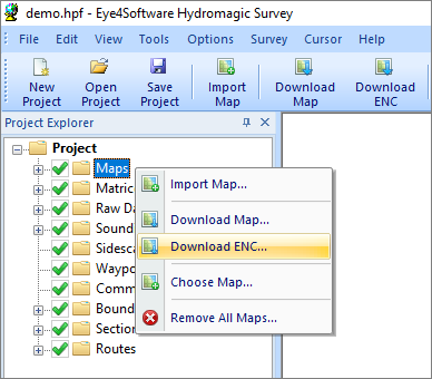
Right click the "Maps" folder and select the "Download ENC..."
option to start the ENC downloader.
Selecting charts
In the dialog that appears, select the charts to download by checking the box in front of the chart number. You can use the search field to search by chart name, area, or number. The list will be filtered while you type.
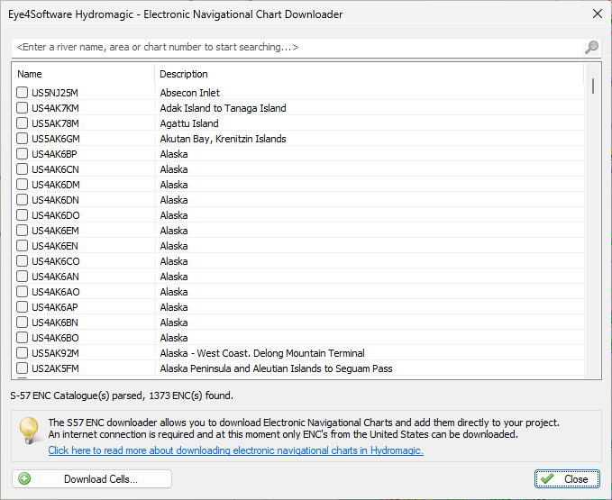
Please select the files to download from the ENC catalog.
Download charts
After selecting the charts to be included in the project, click 'Download Cells...' to download the S-57 cells. While the software downloads and installs the maps, the current progress will be shown.
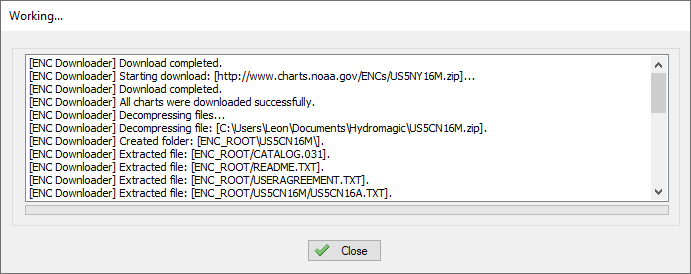
The download process can be monitored in the "Activity View" and progress window.
When the chart(s) have been downloaded and installed, click the 'Close' button to close the progress window. The selected chart(s) will be automatically loaded now.
Video Tutorial
The following YouTube video tutorial shows how to download NOAA S-57 ENC's in Hydromagic. Click below to play the video. When you like the video, please click the like button and subscribe so you will receive an update when new video tutorials on Hydromagic are uploaded.
Downloading Electronic Navigational Charts (S-57) using the built in map downloader