
How can I test if my geoid file is working fine without the need to go to the survey location?
To test if a geoid model works as expected (which is recommended before starting your survey), please follow the steps below:
- Make sure that the geoid file is correctly installed or downloaded. For more information, please refer to the geoid files manual page: https://www.eye4software.com/hydromagic/documentation/manual/configuration/geodesy-configuration/manage-geoids/;
- Open or create a project with the same coordinate system as you are going to use the geoid model on;
- In the top menu, go to "Tools" => "Geodesy Calculations" => "Geoid Calculatorą" to start the "Geoid Calculator" tool.
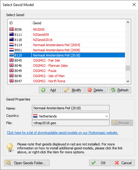
- Click the "Selectą" button and select the geoid model you want to test from the list. When a geoid model is displayed in red, it is not yet installed or downloaded, please see step #1 in this case.
- Enter either the easting and northing or latitude and longitude coordinates of the project location, depending on the setting of the "Use projected coordinates" check box.
- Click the "Calculate" button to calculate the separation value for the selected coordinate. This is the elevation difference between the ellipsoid and the local vertical datum.
When not installed, select the "Download and Install" option.